3.2 How to get Airspace Information
So where can you find this information? We recommend two sources:
- B4UFLY
- Official FAA Sources - VFR Sectional Charts, FAA Facility Maps, TFR/NOTAMs
3.2.1 B4UFLY
The most comprehensive and easy to use Drone airspace map system is B4UFLY. Just type in your address or find your spot on the map, and see whats around you. B4UFLY is available as both a webpage and as an app for iOS or Android.

Figure 3.2: B4UFly
Once you find your flying spot on the map, you can evaluate many of the airspace issues you need to look for. For example, in Figure 3.3, the selected flying spot is within a grid box within the purple shaded region. The text box to the bottom left gives a brief explanation - the purple shaded region is MERCED CLASS E2 airspace - meaning that the location is located within the vicinity of the Merced Airport. Any drone flying within any purple of blue shaded region will require permission from the FAA. Class E2 is the least riskiest of the airport managed airspace (also known as controlled airspace), but still will have some airspace risk with occasional planes and helicopters flying above.
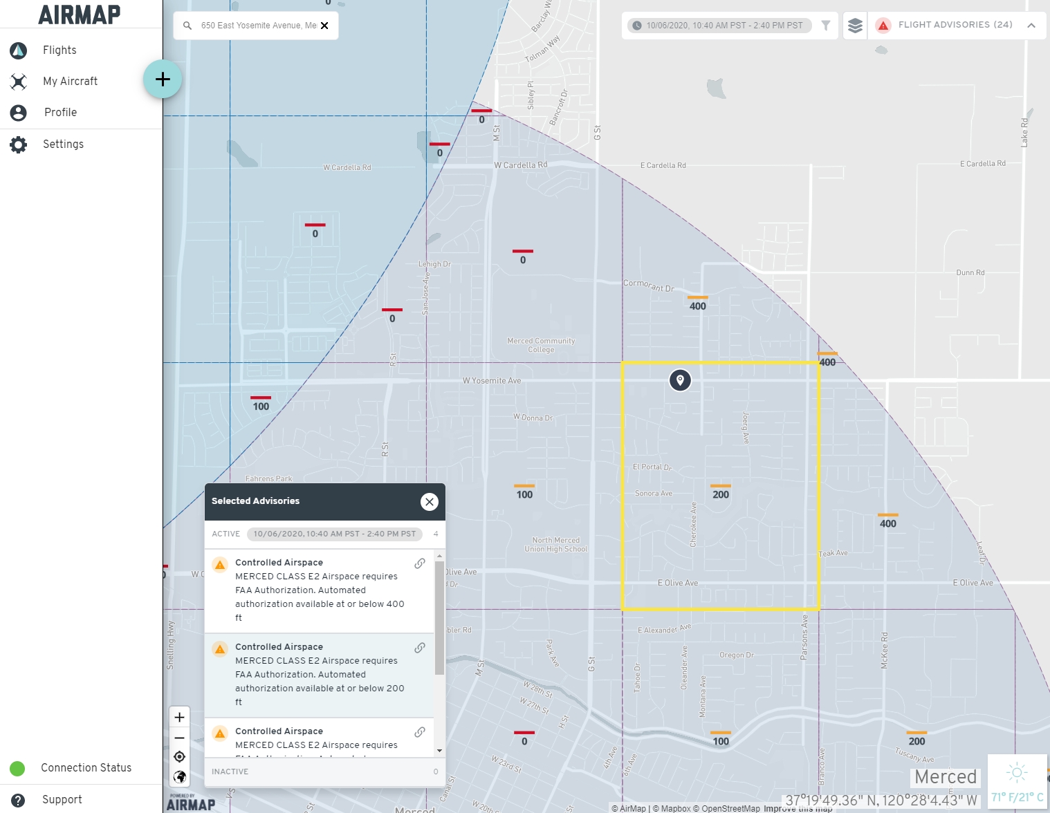
Figure 3.3: Android Airmap Application
For requesting permission to fly within a shaded region (controlled airspace), the FAA and the airports have drawn up grids within the shaded regions and labeled each one with a generally safe upper limit for flying. Within the highlighted grid in Figure 3.3, this limit is 200 ft. If you ask the FAA for permission to fly up to 200 ft, you will always be given approval. In general, the farther away you are from the runway, the higher the altitude you will be allowed to fly. But that’s not always the case - you’ll notice, there are a couple of grids that are marked with a 0 - and yes, that means that the generally safe flying altitude is 0 ft.
Need to get FAA permission to fly in one of these areas, head over here
What if you need to fly higher than the altitude listed? If you have a drone pilot license, you may ask the FAA for permission - but it is not guaranteed to be approved. Obtaining permission for flights above the listed altitude can be tricky, so we recommend reaching out to us at UASsafety@ucmerced.edu and we’ll be happy to walk you through the process. Reach out to us early - the FAA can take 5-10 days to grant approval so you want to start this process early.
3.2.2 The importance of up-to-date Airspace Information
Having the most up-to-date airspace information on hand can make all the difference between having a safe flight and a risky one. One of the advantages of Airmap is that it will also display a number of Temporary Flight Restrictions and Notices to Airman. Especially in California, there are a number of these that we should always keep an eye on:
- Disneyland - Due to National Security Risks, the FAA has banned all aircraft from flying under 3000 ft within 3 miles of Disneyland. This essentially also bans all drones in the area as well.
- Major League Baseball, National Football League and Division 1 College Football Regular and Post-Season Games - Similarly to the Disneyland restriction, the FAA has banned all aircraft from flying under 3000 ft within 3 miles of any these games. The ban starts at 1 hour before the games begin to 1 hour after the game ends.
- Wildfire and other Natural Disasters - Whenever there is a major catastrophe, keep an eye out for Temporary Flight Restrictions. These will often be very large and prolonged to allow emergency services (firefighting aircraft, medical support, etc) to have priority in these areas. Never fly your drone in a manner that could interfere with emergency services - it is both a Federal offense and a State offense.
- US President and Vice-President Travel - The President (30 mile) and Vice-President (5 mile) travel with their own FAA flight restriction zones, similarly prohibiting all aircraft from flying under 3000 ft within their zones.
As with most drone related rules and regulations, there are nuances and exceptions to TFRs and NOTAMs. If you have a pressing need to operate within a TFR, reach out to us at UASsafety@ucmerced.edu to discuss.
3.2.3 Official FAA Sources
Using B4UFLY is one of the easiest methods for looking up most of the airspace issues. However, it’s not always the most detailed nor is it the official source of information. The official sources of information is spread across a handful of different sites:
- Official source of airspace information - FAA Sectional Charts
- Official source of altitude grid information - UAS Facility Maps
- Official source of TFR or NOTAMS - FNS NOTAM Search
Always check multiple sources - you never know when one source omits an important piece of information. For example, Figure 3.4 is the default view of Orange County of the UAS Facility Maps, but its doesn’t depict one very critical flight restriction.
3.2.3.1 FAA Sectional Charts
Getting information on a specific area’s airspace classification has never been easier. The FAA has region specific sectional charts located here.
3.2.4 UAS Facility Maps
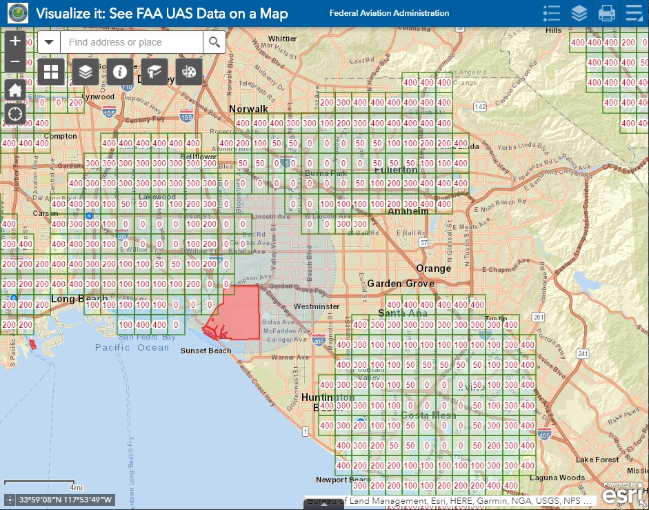
Figure 3.4: UAS Facility Map
UAS Facility Maps show the maximum altitudes around airports where the FAA may authorize drone operations without additional safety analysis. Grids marked in Green are LAANC (Low Altitude Authorization and Notification Capability) enabled - More on that in LAANC Authorization.
3.2.5 NOTAM or Notice To Airman
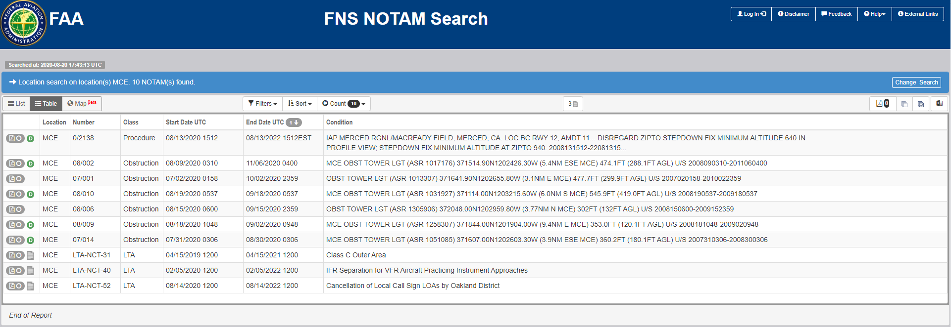
A NOTAM or Notice to Airman, is a notice that pertains to the establishment, change or condition of any facility, service or procedure of a specific location. The information is not known far enough in advance to be publicized by any other means therefore ensuring there are no active NOTAMS in the area you will be flying in is essential to the safety of yourself and others. It is important to keep in mind that NOTAMS can be put up at a moments notice.
3.2.6 SkyVector
SkyVector is a manned aviation tool that allows users to view the FAA Sectional Charts (also known as VFR charts) as well as a wide range of other layers, including TFRs and IFR approaches. While most of the information will be overwhelming for the beginning drone pilot, the basic VFR charts are still a great resource.
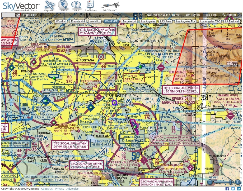
Figure 3.5: SkyVector - VFR Chart viewer with TFRs
3.2.7 Airspace Regulations
On this page, we’re only looking at how to get the most basic of airspace information. But obviously, there’s a deeper level of knowledge to be studied when it comes to airspace regulations. You’ll find more information on the UAS Regulations and Learning About Airspace page, but for now, you can take a quick look at Figure 3.6 below.
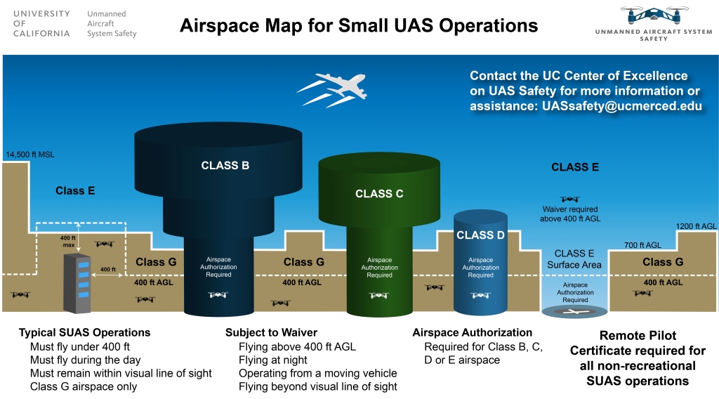
Figure 3.6: Small UAS Airspace Rules